Friday, August 2, 2019

How to establish a nonprofit organization in Oregon


                                   Photo: Siobhan Van Lanen 


With starting a qualified Internal Revenue Code IRC 501 (c)(3) charity, one is required to comply with many federal and state laws as part of the advantage of being tax exempt from federal and state income tax on the organization’s activities.  Charities have two main categories “public foundation or “private foundation.”  (Harroch, Bass, 2017)

In the state of Oregon, registration for a non-profit charitable organization is completed through the Oregon Secretary of State; Bev Clarno.  To be considered valid, registration and certification by the Secretary of State is another requirement.  Also in Oregon, regulation of charitable activities is additionally overseen by the Department of Justice.  There are several required steps involved in the process of establishing a non-profit organization including selecting a name, state and local corporation registration, obtaining tax numbers, and satisfying requirements for insurance. (https://sos.oregon.gov/business/Pages/nonprofit.aspx)  Additionally, selecting a minimum of three participants whom will serve as directors is necessary. (Nolo, n.d.)

Name Selection

It’s important for the name to be distinguishable from other business entities on record from the time of filing. Name restrictions are on the words “cooperative” and “limited partnership.” (Nolo, n.d.) Explore the Oregon Secretary of State’s Business Name Search Tool for possible name choices and to make sure you’re not taking an already existing organization’s name. This can be found at http://egov.sos.state.or.us/br/pkg_web_name_srch_inq.login

Choose a memorable, simple, short name easy to pronoun and spell which expresses the organization and has emotional appeal.  Consider meaningful keywords that reveal; who, what, where, why and how as it relates to an understanding of the organization. Acronyms can also work well in name selection.  Remember to narrow your focus and do research to find out if the name you choose is available with a website domain name too (Nonprofit Ally, 2015).

State and Local Corporation Registration

Local city and county clerks can help provide information on requirements and are a good resource.
The Secretary of State Corporation Division requires that nonprofit organizations register through them.  There is an annual renewal requirement too.  To do this efficiently, one can register online at: https://secure.sos.state.or.us/oim/login?oimAction=renew&p_a_cd=CBR&p_fp_gurl=https://secure.sos.state.or.us/cbrmanager/login.action

Obtaining Tax Numbers

The Oregon Secretary of State website provides interested parties with helpful resources with links to tax registration information from the Oregon Department of Revenue necessary for establishing a charitable tax- exempt, nonprofit organization.  They list several links some of include:

Charities and nonprofit organization tax information


There are also phone numbers for technical assistance and forms: 877-829-5500 and 800-829-1040.


Regulations for charitable organizations


Satisfying Requirements for Insurance

Obtaining insurance is also a requirement for a charitable organization and the Secretary of State advocates The Oregon Insurance Division as a good resource.


References

Non-Profit Services (n.d.) Oregon Secretary of State: Bev Clarno

Retrieved from


Business Name Search (n.d.) Oregon Secretary of State Corporation Division

Retrieved from


Harroch, D. Richard, Bass, D. Harris (2017) 15 Key Steps To Set Up A Charity: Forbes

Retrieved from


How to Name your Nonprofit or Business (2015) Nonprofit Ally

Retrieved from

https://www.youtube.com/watch?v=cJw4jHkqquw


How to Form an Oregon Nonprofit Organization: The steps to form a 501 (c)(3) nonprofit corporation in Oregon (n.d.) NOLO

Retrieved from


Registration for nonprofit organization (n.d.) Oregon Secretary of State Access System

Retrieved from


Charities and Nonprofit Organizations (n.d.) Internal Revenue Service

Retrieved from


Charitable Organizations (n.d.) Internal Revenue Service

Retrieved from


Division of Financial Regulation (n.d.) State of Oregon

Retrieved from


Sunday, July 14, 2019

Mobile App for Species Identification: Merlin's Bird ID by Cornell Ornithology Lab


I found several species identification apps available online.  With a variety of bird species inhabiting Fitton Green Natural Area to explore, I decided to download the free field guide Merlin App, powered by eBird, to use when I’m on the trails.  Being able to learn about and identify birds with photos using this app from one’s iPhone or Android smart phone is an incredible technology feature.  Developed by the Cornell Lab of Ornithology, beginner and intermediate biophilic bird watchers can practice bird identification, learn about habitat characteristics, and listen to sound recordings to confirm the accuracy of species identification.  It is easy to use! 

After downloading the app. I began traversing the vast digital world of bird data made available from millions of bird sightings across the United States with over 15,000 bird photos.  The Cornell Lab of Ornithology professionals share tips for identification that I found helpful.  I was impressed how the Merlin app identifies over 2,000 North American common bird species.

Starting the process, I clicked onto “Bird ID” then it asks “Where did you see the bird?” I entered in Philomath, OR.  It then asks, “When did you see the bird?”  I entered in July 14.  The next page asks “What size was the bird?” with four pictures of birds varying from small to large.  Since I thought I saw a chickadee I clicked the circle under the smallest bird icon (when you check the circle it indicates below ‘sparrow-sized or smaller.’  Then, on the next page, Merlin asks, “What were the main colors?” Participants are able to select from 1 to 3 main colors.  I entered black and white.  Next, the question is “Was the bird…?” Participants can select from “Eating at a feeder, swimming or wading, on the ground, in the trees or bushes, on a fence or wire, or soaring and flying.” I selected ‘In trees or bushes.’   Then, it says ‘Creating a list of birds…’  Almost instantly, I’m provided an extensive list of potential birds.  For each bird species there is a high definition close up picture. Below the photo is a detailed physical description of the bird, a sound recording and a ‘details’ feature.

 After I looked through the list, exploring the features, I clicked onto the ‘This is my bird’ as I thought that the bird I saw was a Black-capped Chickadee.  Merlin then posts ‘Congratulations! You identified Black-capped Chickadee.  It says “Your response has been recorded to improve Merlin’s accuracy. To save your eBird Life List, submit this with the eBird app.” It also offer the option for users to share the ID to an email address as well as a link to “Explore Species Details.” Merlin gives excellent detailed description of the Black-capped Chickadee “Tiny, plump-bodied, big-headed bird is a familiar woodland resident and backyard visitor in the northern U.S. and Canada. Gray overall with buffy flanks and a contrasting head pattern: black cap, white cheek, and a black throat.  Short, stubby bill is used for hammering open seeds.  Often the core of mixed flocks of songbirds.”  

Additionally, Merlin Bird ID offers a map of the U.S. for each bird species.  The map highlights the regions it inhabits and indicates year-round, migration, breeding and non-breeding. I went further to explore other resident birds of the Willamette Valley Pacific Northwest region, including one of my personal favorites, the Acorn Woodpecker which I often frequently hear at home pecking like a drummer on trees trunks in the morning.

My favorite feature of the Merlin App is the sound recordings.  Most times when I’m at a park, I hear bird songs but can’t see the birds because they are perched in trees, obscured by branches and leaves or they are in flight.  A fulfilling experience as part of a nature wellness walk is fully immersing one’s senses in the songs of birds.  I find actively engaging my auditory sense in listening to the music of birds is a form of meditation, attuning to the rhythms and melodies of their unique calls.  I have to say, the Merlin app is an excellent learning tool for anyone wanting to enhance their sense of place in the living bird communities of urban and rural parks, open spaces, protected areas and our own backyard.  I will be using it on my future walks!

Reference

Cornell Lab Merlin
Retrieved from


Monday, July 1, 2019

Available Resources
In the past month of research on the topic of biodiversity and current threats at Fitton Green Natural Area, I found a broad range of available local, regional and national educational resources from city, county, government agencies and ex situ and in situ conservation organizations.  Local citizens interested in a connection to this community park and sense of place and gratitude have many opportunities to learn about the ecology, wildlife, habitat characteristics, species classification and vegetation communities.  With these resources, decision-makers and policy-makers can guide conservation decisions to preserve biodiversity and encourage a stewardship mindset for future generations.

Prairie Species Habitat Conservation Plan-Species list. (n.d.) Benton County Natural Areas and Parks  Retrieved from

Plants Database (n.d.) United States Department of Agriculture Natural Resources Conservation Science

Bradshaw’s Lomatium (n.d.)  U.S. Fish and Wildlife Service
Retrieved from

Nelson’s Checkermallow, Fender’s Blue Butterfly (n.d.) The Oregon Conservation Strategy, Oregon Fish and Wildlife 

Peacock Larkspur (n.d.) Oregon Department of Agriculture
Retrieved from

Taylor’s Checkerspot (n.d.) Oregon Zoo
Retrieved from

 Benton County Prairie Conservation Strategy prepared by Institute for Applied Ecology (2010) U.S. Fish and Wildlife Service  
Retrieved from

Fender’s blue (Icaricia icariodes fender) (n.d.) Xerces Society for Invertebrate Conservation
Retrieved from

Perspectives: Fender’s Blue Butterfly (n.d.) Oregon State University

Retrieved from

Oregon May be Over-Hunting Cougars-Which Could Cause More Conflicts, Ross, Erin (2018) Oregon Public Broadcasting

Retrieved from

https://www.opb.org/news/article/cougar-overhunting-conflict-oregon/ (Links to an external site.)

Index of Species Information: Canis latrans (n.d.) United States Department of Agriculture

Oregon State University Small Farms Program (2018) Oregon State University

Oregon elk management options studied by ODFW biologists, wildlife managers (2019) Statesman Journal

Retrieved from

https://www.statesmanjournal.com/story/news/2019/06/12/oregon-elk-management-options-studied-odfw-wildlife-managers/1430025001/ (Links to an external site.)

Acorn Woodpecker (n.d.) Oregon Conservation Strategy
Historical Vegetation of the Willamette Valley, Oregon circa 1850 (n.d.) BioOne Complete
Retrieved from
Fender’s Blue butterfly (n.d.) U.S Fish and Wildlife Service, Oregon Fish and Wildlife Office
Retrieved from

The Problem with Invasive Plants (n.d.) The City of Portland Oregon Environmental Services ‘working for clean rivers’

Oregon’s Forests Filled With Fungus That Offers Promise For Fuels, Eating Contamination (2012)  The Oregonian

Topic 2.1 Species and Populations (n.d.) Amazing World of Science with Mr. Green

Ecological Fire Crews Conduct Burn (n.d.) U.S. Army Corps of Engineers Portland District

Controlled Burn Set Today (2015) Benton County Natural Areas and Parks Department

What is the difference between threatened and endangered (n.d.) U.S. Fish and Wildlife Service Retrieved from https://www.fws.gov/midwest/wolf/history/e-vs-t.html (Links to an external site.)

Western Oregon Zone 6: Willamette and Columbia River Valleys (n.d.) Sunset

Web Soil Survey (n.d.) United States Department of Agriculture

Retrieved from


Managing Himalayan Blackberry in Western Oregon Riparian Areas (2006). Oregon State University Extension


Retrieved from


Himalayan Blackberry (n.d.) United States Department of Agriculture

Retrieved from


Cirsium arvense-Canada thistle (n.d.) Oregon State University
Retrieved from

Canada Thistle Cirsium arvense (n.d.) MPG North
Retrieved from

B Rated Weeds (n.d.) Oregon Department of Agriculture
Retrieved from
Resource Stewardship Plan for Benton County Natural Areas and Parks Department (2011). Benton County Natural Areas and Parks
Retrieved from

Oregon Department of Agriculture Noxious Weed Pest Risk Assessment (2015). Oregon Department of Agriculture

Retrieved from
English Hawthorne (Crataegus monogyna) (n.d.) Weed Wise: A conservation program of the Clackamas SWCD
Retrieved from

Willamette Daisy (Erigeron decumbens) (n.d.) Oregon Department of Agriculture
Bradshaw’s desert parsley (Lomatium bradshawii) (n.d.) Oregon Department of Agriculture

Kincaide’s Lupine (Lupinus oreganus) (n.d.) Oregon Department of Agriculture

Peacock’s larkspur (n.d.) Oregon Department of Agriculture
Retrieved from

Thursday, June 27, 2019

  
Image: United States Department of Agriculture 
Natural Resources Conservation Service Web Soil Survey
Fitton Green Natural Area 33721 to 33723 Mary's River Estates Rd. Philomath, OR Benton County (central location at orange flag). 

Searching through NRCS Web Soil Survey has been a growth experience as a new user.  Starting with the 'Area of Interest' tab, I entered the address listed online for Fitton Green Natural Area 33721 to 33723 Mary's River Rd, Philomath, OR 97370.  After entering state and county under soil survey area link, it showed the area symbol OR003 with data availability as tabular and spatial complete. Then listed is the versions Survey Area: Version 16, Tabular: Version 14, Spatial: Version 3, all dated Sept.18, 2018.  The digital versions of data are up-to-date with very detailed information which is useful for land-use planning for both economic and recreational activities and conversation efforts.
Next, I navigated to one of the features of the web soil survey Area of Interest (AOI) Interactive map and the tab 'Define AOI by Rectangle.'  Above is the image which delineates the boundaries of the landscape. When I created the AOI, it was a very rough estimate of what appears to be the general area but is by no means accurate.  As a first time user, I'm not even sure if I was doing it correctly.  What I believe could be improved is to have a more vivid flag at the site for viewers to see.

The 'Soil Map' tab is accessible after entering the AOI. Under the meandering delineations of soil types highighted in orange, the flag which indicates the location of Fitton Green is surrounded by a delineation with the number 137.   From there I accessed the 'Properties and Qualities Ratings with links to detailed information; soil chemical properties, soil erosion factors, soil health properties, soil physical properties, soil qualities and features, and water features.  I found a listing of various soil types including the soil type for area labeled 137.  The dominant soil is listed under 'Map Unit Legend' as 'Price-MacDunn-Ritner complex, 30 to 60 percent slopes.'


Exploring more, I found I could click onto 'Report-Map Unit Description.' Under 137-MacDunn-Ritner complex, 30 to 60 percent slopes, are map unit setting, map unit composition, description of price with setting and typical profile.  It was interesting to see on map unit setting the mean annual precipitation at 50 to 70 inches, mean annual air temperature at 48 to 54 degrees F and under farmland classification as 'not prime farmland.'   Of special interest to me was the link 'soil erosion factors' as it relates with soil erosion at Fitton Green.  This community park was previously logged and as a result soil erosion is a concern.  Understanding the dynamics of soil gives planners a detailed perspective on how to manage and monitor the landscape.


Web Soil Survey (n.d.) United States Department of Agriculture

Retrieved from
https://websoilsurvey.sc.egov.usda.gov/App/WebSoilSurvey.aspx


Tuesday, June 25, 2019


There are a broad range of evidence-based, credible sources which point to the impacts of global climate change.  Within the context of this blog, here are some resources which examine the impacts of these anthropogenic pressures on the Pacific Northwest USA.  There are a variety of images which help viewers understand climate change patterns through spatial and temporal scales.  These resources with maps illustrate changing climate patterns which indicate longer summers with higher temperatures and extreme weather events on the West coast.  Increased frequency and severity of wildfires from extremely dry seasons is a threat as wildfire regimes have undergone major alterations with fire suppression from urban development.  Other impacts of climate change are more severe storms, increased precipitation and rising sea levels.

Sea Level Rise for the Coasts of California, Oregon, and Washington: Past, Present and Future (2012) The National Academics of Sciences, Engineering and Medicine

Retrieved from
Liberto Di, Tom (2017) Heat wave scorches the Pacific Northwest
Retrieved from
Liberto Di, Tom (2015) Wildfires burn up western North America
Retrieved from
Liberto Di, Tom (2015) This summer’s West Coast algal bloom was unusual.  What would usual look like?
Retrieved from

NCA Education Resources for the Northwest Region (n.d.)
Retrieved from

Wednesday, June 5, 2019


                    What is Biodiversity?


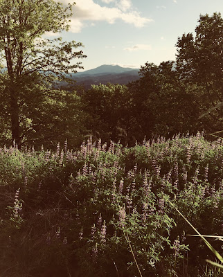
Fitton Green Natural Area, Benton County, Philomath,Oregon Photo: Siobhan Van Lanen 


A healthy planet depends upon biodiversity to sustain all life. Biodiversity is the planet Earth’s interconnected and interdependent vast network of biological communities, from species and ecosystems to the variety of genes enabling species populations and survival.  Biodiversity is the interaction and relationship between living organisms, plants and animals inhabiting ecosystems and adapting to changing environmental conditions, ecological systems and processes of evolution that support life. It can also be described as the relationship that humans from diverse cultural backgrounds have with the landscapes they inhabit.  Diverse human cultures interacting with their environment is an important social component of biodiversity.  Back in the 1980s, the word biodiversity was associated most with species richness but evolved to ecosystem and genetic diversity. Research programs were designed to understand the three levels of biodiversity. (Valera, Bertolaso, 2016) 
  
From microbes to terrestrial and marine biological communities, a variety of species and ecosystems and genes are essential for long-term environmental and human health. In 2005 the Millenial Ecosystem Assessment established a framework for the values humans place on nature and coined the term ‘ecosystem services’ which identifies and categorizes four categories of ecosystem services: provisional (food, shelter, medicine), regulating (climate and disease control), supporting (cycling of nutrients and pollinators), and cultural (recreation, education, culture, spiritual/religious).  All ecosystem services are important for social and ecological resilience with (Australia State of the Environment, 2016). The Millenial Ecosystem Assessment builds a strong foundation in the importance of preserving and protecting biodiversity for social and ecological resilience with environmental threats like climate change, pollution, habitat loss and invasive species.


Fitton Green Natural Area, Benton County, Philomath, Oregon  Photo: Siobhan Van Lanen

The preservation of biodiversity from accelerating anthroprogenic pressures needs to be addressed on a broad spatial scale.  Individual actions and social responsibility are a crucial part of conservation solutions but policy-making on a local, regional and national and international level which engages a variety of stakeholders over political boundaries is necessary to protect biodiversity.  There is a need for a formal process of regulating economic activities revolved around short-term monetary gain which result in long-term environmental impacts. (California Academy of Sciences, n.d.) The development of local, regional, national and international policy is essential to protect biodiversity from irreversible damage from excessive resource extraction that provide short-term monetary benefits to a very few.  Regulation of logging and strip mining in species-rich ecosystems are an important part of some policies and trade limits on natural resources require enforcement. 

In order to protect biodiversity on all scales, governments need economic pressure put on them.  Policies need to be developed to protect biodiversity all around the world that counter the economically-based policies and treaties that result in the loss of biodiversity. Recycling programs, 'adopt a highway' litter control, local public parkland monitoring, beach clean-ups, plastic bag bans, and community gardens are examples of formal local policies that encourage stewardship. (California Academy of Sciences, n.d.)  A bottom-up approach is part of the solution.  

Developed countries can participate in biodiversity preservation through limiting consumptive behaviors and reducing resource-intensive lifestyles that result in environmental degradation.  Regulation of citizens' wide-use of plastic is essential to reduce plastic pollution degrading marine ecosystems and species.  Examples of regional biodiversity stewardship to reduce plastic pollution is the single-use plastic bans recently implemented in Seattle, Washington and Portland, Oregon.  International and local policies need to be enforced to regulate the over-use of plastic.  Scientific data and research are important for decision making processes and primary studies, field work documentation and citizen science projects help to contribute data confirming the importance of biodiversity preservation and provide evidence-based research that document current anthroprogenic threats. (California Academy of Sciences, n.d.)


References
Valera, Luca.,& Bertolaso, Marta (2016). Understanding Biodiversity From a Relational Viewpoint Topicos, Revista de Filosofia 51, pp.37-54.


The Importance of Biodiversity (2016) Australia State of the Environment Web site: Retrieved from